Oklahoma City Open Data
Transportation
Adopted Streets
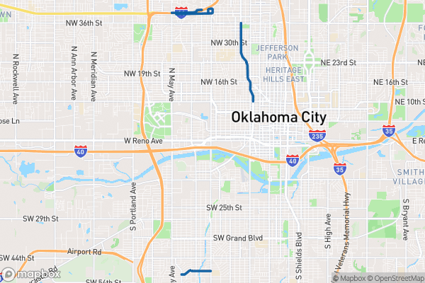
This dataset tracks which Oklahoma City streets have been adopted by organizations through the adopt-a-city-street program
Source city: Oklahoma City · Catalog date: June 9, 2026 · License: custom
What this is
This dataset tracks which Oklahoma City streets have been adopted by organizations through the adopt-a-city-street program.
Why it matters to you
Adopted streets often receive extra attention for litter cleanup and maintenance. If you’re deciding where to open a business, volunteer for cleanup, or report a problem like potholes, knowing which streets have active adopters helps predict how quickly issues might get addressed. Neighborhood groups also use this to coordinate with existing adopters or claim unadopted stretches.
How to read this data
- Street: The name and block range (e.g., “Main St from 1st to 5th Ave”)
- Adopted: The group responsible for upkeep (e.g., a business or nonprofit)
- Length: How long the adopted stretch is (in feet)
Try it yourself
Search the dataset for your street or neighborhood—if it’s unadopted, you might qualify to “claim” it through the city’s program. If already adopted, note the responsible organization to contact about maintenance needs.
The fields, explained
Pulled directly from the source catalog's published field definitions — not paraphrased.
| Field | What it means |
|---|
ObjectID | Numeric unique identifier with no special meaning |
Street | Street name including from and to information |
Adopted | Organization who has adopted street |
Shape | Geographic data in state plane coordinates (WKID 103512) |
Length | Approximate length of feature in US feet |
From the source — real records
Unedited rows from Oklahoma City's published service, pulled when this site was built.
Look it up yourself
Everything on this page comes from the city's public open-data catalog. Anyone can download it — CSV, GeoJSON, KML, or the live service.
This explainer was written from the published catalog record. Always verify against the source dataset before relying on it for a decision.