What this is
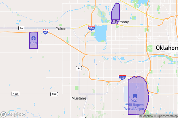
This dataset shows the boundaries and locations of Oklahoma City’s three municipal airports.
Why it matters to you
Knowing airport boundaries helps when making decisions about noise-sensitive developments (like schools or housing near flight paths), understanding zoning restrictions near airport property, or planning transportation routes that connect to airport facilities. Businesses considering locations near airports need this data to assess potential noise impacts or height restrictions.
How to read this data
- Airport Name: Identifies which airport the boundary represents (e.g., Will Rogers World Airport).
- Area: Shows the approximate size of the airport property in square feet.
- Length: Gives the perimeter distance of the airport boundary in feet, useful for understanding the scale of the facility.
Where this leaves you
While this data doesn’t let you look up specific addresses, it provides the big-picture footprint of airport properties—helpful for regional planning or policy discussions about airport-adjacent areas.