Oklahoma City Open Data
Parks & Recreation
City Trails
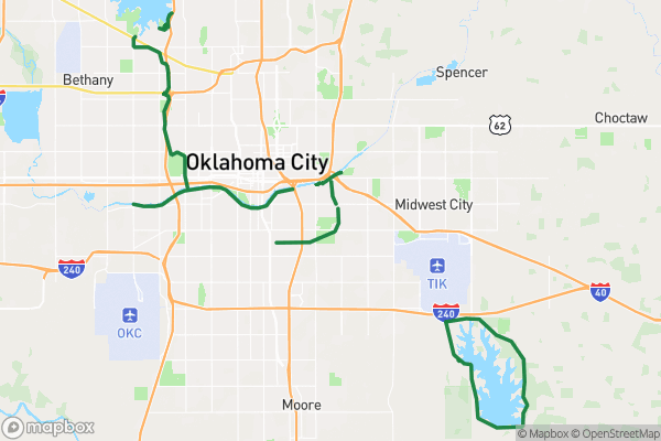
A list of walking and multi-use trails in Oklahoma City parks
Source city: Oklahoma City · Catalog date: June 9, 2026 · License: custom
What this is
A list of walking and multi-use trails in Oklahoma City parks.
Why it matters to you
This data helps you choose where to walk, bike, or ride based on trail rules and features. Need a stroller-friendly path? Looking for horse trails? Want to avoid construction zones? This shows which trails match your needs before you go.
How to read this data
Key fields to check:
- Status: “Open” means ready to use, while “Under construction” means delays
- Rating: Difficulty level (easy/moderate/hard) for planning hikes
- Accessible: “Yes” means ADA-compliant for wheelchairs/strollers
- Motorized/Hike/Bike/Equestrian: Shows what activities each trail allows
Where this leaves you
While you can’t look up trails by address here, this helps compare options across the city for your next outdoor trip. Check the “Trail Name” and “Design Use” to find ones near you.
The fields, explained
Pulled directly from the source catalog's published field definitions — not paraphrased.
| Field | What it means |
|---|
ObjectID | Numeric unique identifier with no special meaning |
Trail Name | Name of trail |
Status | Indicates if trail is currently open, partially complete, or under construction |
Rating | Indicates the difficulty of the trail |
Design Use | Indicates the general use the trail was designed for |
Accessible | Indicates the ADA accessibility of the trail |
Motorized | Indicates if motorized vehicles are allowed on trail |
Hike | Indicates if trail is suitable walking or hiking |
Road Bike | Indicates if road bikes are allowed on trail |
Mountain Bike | Indicates if mountain bikes are allowed on trail |
Equestrian | Indicates if horses are allowed on trail |
Shape | Geographic data in state plane coordinates (WKID 103512) |
Length | Approximate length of perimeter of feature in US feet |
From the source — real records
Unedited rows from Oklahoma City's published service, pulled when this site was built.
Look it up yourself
Everything on this page comes from the city's public open-data catalog. Anyone can download it — CSV, GeoJSON, KML, or the live service.
This explainer was written from the published catalog record. Always verify against the source dataset before relying on it for a decision.