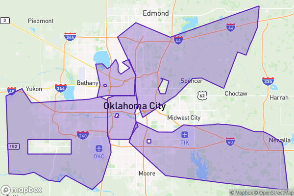
What this is
Oklahoma City is divided into wards, and each ward elects one council member. This dataset is the official map of those boundaries and who currently represents each one.
Why it matters to you
Every city service you care about — potholes, parks, zoning, police response — is filtered through your council member’s office. When a street light is out for weeks, the person who can actually make it move is the ward representative. This dataset tells you which one is yours, and it’s also the answer key for questions like “why is this development in my neighborhood?” — because land-use decisions live on a ward map too.
How to read this data
- Ward — the number of the district (Oklahoma City has 8).
- Council Member — the current representative’s name. This field changes with every election, so the dataset is only as current as its last update.
- Area — the size of the ward in square feet. Wards are drawn to be roughly equal in population, not in size — which is why some look huge and empty and others small and dense.
Try it yourself
Find your address on the ward map and note the Ward number. Then look up when your council member’s term ends and whether your ward is up for election this year — most people discover they vote for city council more often than they thought.