Oklahoma City Open Data
Infrastructure
Land Documents
This dataset tracks legal land documents like deeds, easements, and ordinances filed with the city
Source city: Oklahoma City · Catalog date: July 28, 2026 · License: custom
What this is
This dataset tracks legal land documents like deeds, easements, and ordinances filed with the city.
Why it matters to you
These records affect property rights, construction plans, and neighborhood changes. For example:
- If you’re buying a home, checking for easements (like utility access) could reveal hidden limits on your property.
- A new ordinance might block a business expansion you’re planning.
- Deeds show who legally owns or transfers land—key for disputes or development.
How to read this data
Key fields include:
- Document Type: Tells you if it’s a deed (ownership transfer), easement (shared rights), or ordinance (local law).
- Location/Address: Where the document applies—compare to your property or area of interest.
- Grantor: Who signed over rights (e.g., a seller or government agency).
Try it yourself
Search the dataset for your address or street to see:
- Active easements (like sidewalks or pipelines crossing your land).
- Recent ordinances that might affect renovations or zoning.
- Past deeds to trace property ownership history.
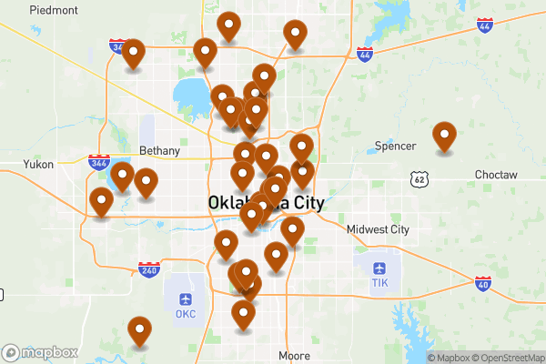
See it on a map
Markers at the dataset's published locations — click one for the record's details.
The fields, explained
Pulled directly from the source catalog's published field definitions — not paraphrased.
| Field | What it means |
|---|
ObjectID | Numeric unique identifier with no special meaning |
Document Type | Type of land document |
Document Number | Identifying number of document |
Location | Description of area the document applies to |
Address | Address, if any, associated with document |
Grantor | Grantor of legal document |
Reference | Ordinance or case number, if any, associated with document |
Shape | Geographic data in state plane coordinates (WKID 103512) |
From the source — real records
Unedited rows from Oklahoma City's published service, pulled when this site was built.
Look it up yourself
Everything on this page comes from the city's public open-data catalog. Anyone can download it — CSV, GeoJSON, KML, or the live service.
This explainer was written from the published catalog record. Always verify against the source dataset before relying on it for a decision.