Oklahoma City Open Data
Transportation
Snow Routes
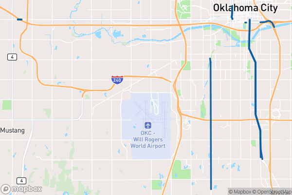
This dataset tracks which streets Oklahoma City prioritizes for snow and ice treatment during winter storms
Source city: Oklahoma City · Catalog date: June 18, 2026 · License: custom
What this is
This dataset tracks which streets Oklahoma City prioritizes for snow and ice treatment during winter storms.
Why it matters to you
Knowing your nearest snow route helps you plan safer winter travel. If you live near or commute along these roads, they’ll be cleared first after a storm. This affects decisions like which route to take to work, where to park overnight during snow forecasts, or whether your child’s school bus route will run on time.
How to read this data
- Quadrant: Shows which general area of the city the route serves (e.g., NW, SE)
- Location 1: The main street name that gets treated (e.g., “N Western Ave”)
- Location 2: Cross streets or additional details about the treated stretch
Try it yourself
Check if your street is a snow route by searching the dataset for your nearest major road. If it’s listed, expect quicker plowing after storms. If not, plan for longer delays or consider alternative routes.
The fields, explained
Pulled directly from the source catalog's published field definitions — not paraphrased.
| Field | What it means |
|---|
ObjectID | Numeric unique identifier with no special meaning |
Quadrant | Regional area of the City of Oklahoma City |
Location 1 | Primary description of location being treated, typically by street name |
Location 2 | Secondary description of location being treated, typically by cross street name(s) |
From the source — real records
Unedited rows from Oklahoma City's published service, pulled when this site was built.
Look it up yourself
Everything on this page comes from the city's public open-data catalog. Anyone can download it — CSV, GeoJSON, KML, or the live service.
This explainer was written from the published catalog record. Always verify against the source dataset before relying on it for a decision.