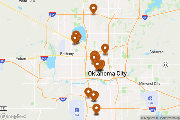
A map of storm sewer connection points like drain inlets and manholes across Oklahoma City
Source city: Oklahoma City · Catalog date: June 3, 2026 · License: custom
What this is
A map of storm sewer connection points like drain inlets and manholes across Oklahoma City.
Why it matters to you
When heavy rain hits, these junctions determine where water pools or flows. Knowing their locations helps you:
Report flooding risks near your property
Check if new construction might block drainage
Understand why certain streets flood repeatedly
How to read this data
Key fields include:
Sub Type: What kind of junction it is (e.g., inlet box, manhole)
Location: A written description of where it’s placed (e.g., “NW corner of 5th and Hudson”)
Project Number: Links the junction to a city construction project (if applicable)
Try it yourself
Search the map for junctions near your home or business—note any that are clogged or damaged, and report them to Public Works with the ObjectID for faster service.
(Note: “Shape” field is for GIS professionals and won’t help most residents.)
See it on a map
Markers at the dataset's published locations — click one for the record's details.
The fields, explained
Pulled directly from the source catalog's published field definitions — not paraphrased.
Field
What it means
ObjectID
Numeric unique identifier with no special meaning
Sub Type
Type of headwall
Project Number
Public Works project number associated with headwall
Location
Text description of location
Comments
Comments related to headwall
Shape
Geographic data in state plane coordinates (WKID 103512)
From the source — real records
Unedited rows from Oklahoma City's published service, pulled when this site was built.
SUBTYPE
PROJECTNUMBER
INLETSIZE
Location
COMMENT
2
2
65E87
4
NW 28th & N Youngs Blvd
2
2
4
1
64E114
NW 23rd & N Pennsylvania Ave
2
2
64E114
NW 23rd & N Pennsylvania Ave
2
Check survey
Look it up yourself
Everything on this page comes from the city's public open-data catalog. Anyone can download it — CSV, GeoJSON, KML, or the live service.