Oklahoma City Open Data
Public Safety
Storm Siren Sectors
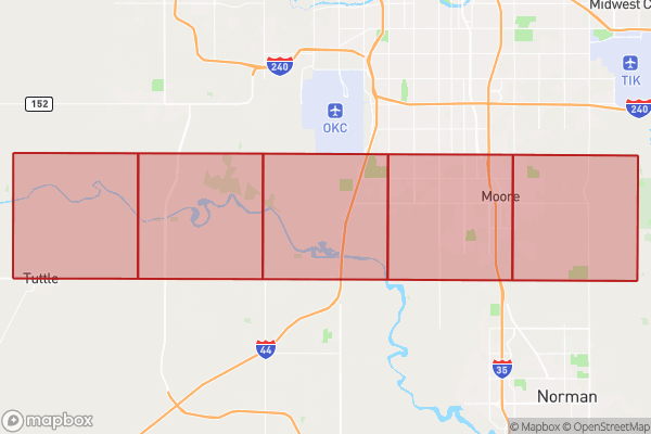
This dataset tracks the sectors where storm sirens activate during emergencies
Source city: Oklahoma City · Catalog date: June 9, 2026 · License: custom
What this is
This dataset tracks the sectors where storm sirens activate during emergencies.
Why it matters to you
Storm sirens warn you about tornadoes and other severe weather. Knowing your sector helps you:
- Verify if your neighborhood’s sirens are working during tests
- Report gaps in siren coverage to local officials
- Understand which alerts apply to your location
How to read this data
Key fields include:
- Grid Number: Identifies your sector (e.g., “Sector 12”).
- Shape: The geographic area covered by the siren (measured in square feet).
- Length: The boundary length of the sector (measured in feet).
Where this leaves you
This data doesn’t let you look up sectors by address, but you can ask emergency services which sector you’re in during community preparedness events.
The fields, explained
Pulled directly from the source catalog's published field definitions — not paraphrased.
| Field | What it means |
|---|
ObjectID | Numeric unique identifier with no special meaning |
Grid Number | Numeric value of grid sector |
Shape | Geographic data in state plane coordinates (WKID 103512). Area -Approximate area of feature in US square feet |
Length | Approximate length of perimeter of feature in US feet |
From the source — real records
Unedited rows from Oklahoma City's published service, pulled when this site was built.
Look it up yourself
Everything on this page comes from the city's public open-data catalog. Anyone can download it — CSV, GeoJSON, KML, or the live service.
This explainer was written from the published catalog record. Always verify against the source dataset before relying on it for a decision.