What this is
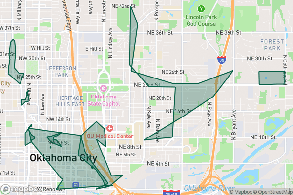
A map of the city’s Tax Increment Financing (TIF) districts — the areas where Oklahoma City has agreed to use future property-tax growth to pay for development today.
Why it matters to you
TIF is one of the most powerful — and least understood — tools a city has. When a big development gets a TIF, the tax revenue the development would generate is diverted to pay for the infrastructure that makes it possible: roads, sewers, parking garages. For residents, that can mean a new downtown without raising taxes… or it can mean public money quietly subsidizing a private project. Knowing where the TIF districts are is the first step to forming your own opinion on whether they’re working.
How to read this data
- District — the name of the TIF area. These are the headline redevelopment zones: core downtown, riverfront, and similar.
- Year — when the district was created. Older districts may have already paid off their obligations; newer ones are still spending.
- Shape / Area — the physical boundary. The catalog is honest: boundaries are approximate and some areas fall in multiple overlapping districts.
Try it yourself
Pick a TIF district and find its Year. Then ask: what’s been built in that area since? That’s the whole TIF argument in one question — did the future tax growth the city bet on actually show up?